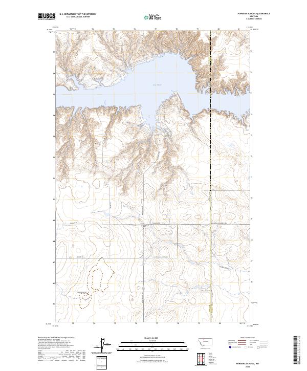
2024 Map of Pondera School
USGS Topo · Published 2024About this map
Lake Elwell dominates the northern landscape of this Toole County quadrangle, where the Marias River basin meets the high plains. The terrain is defined by dramatic coulees and breaks, including Timber Coulee, which cut through the agricultural benchlands. This 2024 survey documents a network of rural routes that speak to the area's deep-rooted ranching and homesteading history, most notably Old Pondera School Rd and the evocatively named Dead Indian Rd. The map also traces the Bootlegger Trl, a historic path through the Montana prairie. Modern access points like Fishing Access Rd along the lake's jagged shoreline indicate the area's contemporary role as a recreation destination. The boundary between Toole and Liberty counties runs through the eastern portion of the sheet, dividing this sparsely settled expanse of the Golden Triangle region.
Find a feature on this map
16 named features on this map. Tap any name to fly to it.
Don’t see what you’re looking for? This feature index may not catch every label — zoom into the map to look around manually.
Map Details
Editions of this 2024 Pondera School Map
This is the sole edition of this map. No revisions or reprints were ever made.
Other maps of this area

1954 · Shelby
USGS Topo · 1:250,000

1958 · Shelby
USGS Topo · 1:250,000

1970 · Carlson Coulee
USGS Topo · 1:24,000

1970 · Knees NE
USGS Topo · 1:24,000

1970 · Sollid School
USGS Topo · 1:24,000

1970 · Pondera School
USGS Topo · 1:24,000

1970 · Devon
USGS Topo · 1:24,000

1970 · Galata
USGS Topo · 1:24,000
1970 · Denson Ranch
USGS Topo · 1:24,000

1970 · Lothair SW
USGS Topo · 1:24,000