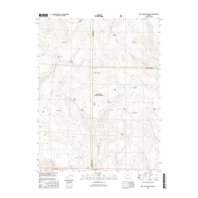
2016 Map of Pool Table Mountain
USGS Topo · Published 2016About this map
Pool Table Mountain stands at the center of this high-altitude landscape within the Rio Grande National Forest, where the borders of Mineral, Saguache, and Rio Grande counties converge. The terrain is defined by a series of alpine parks and mesas, including Palmer Mesa and Divide Park, separated by steep drainages like Cañon Nieve and Cañon Fernandez. An extensive network of primitive paths, such as the Wheeler Trail and Wannamaker Trail, crisscrosses the La Garita Mountains, indicating the area's primary use for forest management and backcountry recreation. The drainage pattern is complex, with headwaters like Embargo Cr and E Bellows Cr carving deep into the volcanic upland. This mid-2010s survey illustrates a region largely devoid of permanent settlement, where named features such as Fish Park and Corral Park suggest a history of seasonal grazing or early surveying camps.
Find a feature on this map
51 named features on this map. Tap any name to fly to it.
Don’t see what you’re looking for? This feature index may not catch every label — zoom into the map to look around manually.
Map Details
Editions of this 2016 Pool Table Mountain Map
This is the sole edition of this map. No revisions or reprints were ever made.
Other maps of this area

1914 · Creede
USGS Topo · 1:125,000

1916 · Creede
USGS Topo · 1:125,000

1945 · Durango
USGS Topo · 1:250,000

1953 · Durango
USGS Topo · 1:250,000

1954 · Durango
USGS Topo · 1:250,000

1957 · Spar City
USGS Topo · 1:62,500

1959 · Creede
USGS Topo · 1:62,500

1961 · Durango
USGS Topo · 1:250,000

1963 · Durango
USGS Topo · 1:250,000

1966 · Durango
USGS Topo · 1:250,000