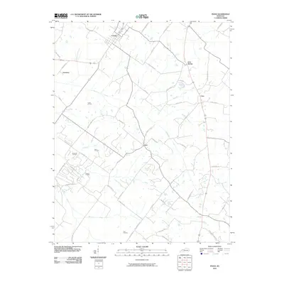
2010 Map of Poole
USGS Topo · Published 2010About this map
Corydon stands as the primary settlement in this portion of Henderson County, situated along a network of rural roads that connect small communities like Jonesburg, Dixie, and Cairo. The landscape is defined by the drainage patterns of Beaverdam Creek and its North Fork, alongside the meandering paths of Highland Creek and Whitelick Creek. For those tracing local family histories, the map identifies several geographically dispersed burial sites, including Hughes Cemetery, Dixon Cemetery, and Tapp Cemetery. The road system is remarkably detailed, naming family-linked thoroughfares such as Lod Powell Rd, B E Overfield Rd, and Dr Floyd Rd, which reflect the long-standing agricultural and land-ownership patterns of the region into the early 21st century.
Find a feature on this map
54 named features on this map. Tap any name to fly to it.
Don’t see what you’re looking for? This feature index may not catch every label — zoom into the map to look around manually.
Map Details
Editions of this 2010 Poole Map
This is the sole edition of this map. No revisions or reprints were ever made.
Other maps of this area

1906 · Sebree
USGS Topo · 1:62,500

1907 · Morganfield
USGS Topo · 1:62,500

1914 · Henderson
USGS Topo · 1:48,000

1916 · Henderson
USGS Topo · 1:62,500

1917 · Uniontown
USGS Topo · 1:62,500

1949 · Sebree
USGS Topo · 1:24,000

1949 · Poole
USGS Topo · 1:24,000

1949 · Robards
USGS Topo · 1:24,000

1951 · Dixon
USGS Topo · 1:24,000

1951 · Poole
USGS Topo · 1:24,000