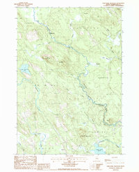
1987 Map of Porcupine Mountain
USGS Topo · Published 1987About this map
Dennys River flows through this corner of Washington County, defining a landscape shaped by water and timber resources in the late 1980s. The map illustrates the rural character of the region, where small settlements like Pine Corner and Marion are linked by winding roads through wooded terrain. The drainage of Gilman Brook, supported by the Gilman Dam, joins the river near Gardner Rips, highlighting the significance of the waterway's descent and the local importance of these specific river features.
Find a feature on this map
36 named features on this map. Tap any name to fly to it.
Don’t see what you’re looking for? This feature index may not catch every label — zoom into the map to look around manually.
Map Details
Editions of this 1987 Porcupine Mountain Map
This is the sole edition of this map. No revisions or reprints were ever made.
Other maps of this area

1907 · Eastport
USGS Topo · 1:48,000

1908 · Eastport
USGS Topo · 1:62,500

1929 · Calais
USGS Topo · 1:48,000

1929 · Robbinston
USGS Topo · 1:48,000

1931 · Robbinston
USGS Topo · 1:62,500

1932 · Calais
USGS Topo · 1:62,500

1941 · Gardner Lake
USGS Topo · 1:62,500

1943 · Gardner Lake
USGS Topo · 1:62,500

1943 · Eastport
USGS Topo · 1:62,500

1945 · Eastport
USGS Topo · 1:62,500