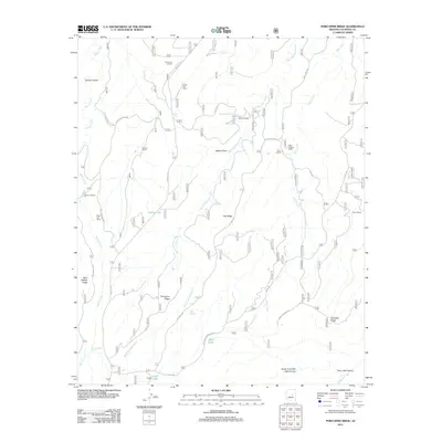
2011 Map of Porcupine Ridge
USGS Topo · Published 2011About this map
Dutch Joe Ranch and Vincent Ranch sit among the high plateaus and drainages of Coconino County in this 2011 survey. The landscape is defined by a series of prominent ridges including Porcupine Ridge, Dye Ridge, and Chevelon Ridge, which separate the many tributaries of Chevelon Creek. This map documents a high-country network of ranching and timber activity, evidenced by the Nagel Logging Camp and the presence of the Dutch Joe Lookout to the north. A complex system of forest roads and trails, such as Wallace Rd and the Hart Canyon Loop, connects remote water sources like Dudley Lake and Alder Lake. The cartography captures a specific mix of natural springs and man-made tanks, including Cliff Springs and the Bennett Butler Tank, essential for sustaining livestock and operations in this arid high-elevation terrain.
Find a feature on this map
35 named features on this map. Tap any name to fly to it.
Don’t see what you’re looking for? This feature index may not catch every label — zoom into the map to look around manually.
Map Details
Editions of this 2011 Porcupine Ridge Map
This is the sole edition of this map. No revisions or reprints were ever made.
Other maps of this area

1886 · Holbrook
USGS Topo · 1:250,000

1887 · Verde
USGS Topo · 1:250,000

1892 · Verde
USGS Topo · 1:250,000

1893 · Holbrook
USGS Topo · 1:250,000

1934 · Promontory Butte
USGS Topo · 1:62,500

1939 · Promontory Butte
USGS Topo · 1:62,500

1952 · Promontory Butte
USGS Topo · 1:62,500

1954 · Holbrook
USGS Topo · 1:250,000

1957 · Holbrook
USGS Topo · 1:250,000

1958 · Holbrook
USGS Topo · 1:250,000