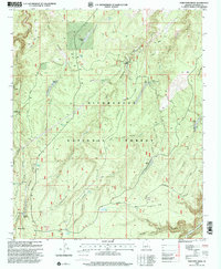
1998 Map of Porcupine Ridge
USGS Topo · Published 2000About this map
Sitgreaves National Forest dominates this high-country landscape, where a network of remote ranches and livestock infrastructure is carved into the canyon-riven terrain of the Mogollon Rim country. The map documents long-established family outposts like Dutch Joe Ranch, Vincent Ranch, and Dye Ranch, which are connected by a system of forest roads such as Chevelon Ridge Road. These ranching sites, alongside the Nagel Logging Camp Corral, reflect the area's historical reliance on timber and grazing.
Find a feature on this map
51 named features on this map. Tap any name to fly to it.
Don’t see what you’re looking for? This feature index may not catch every label — zoom into the map to look around manually.
Map Details
Editions of this 1998 Porcupine Ridge Map
This is the sole edition of this map. No revisions or reprints were ever made.
Other maps of this area

1886 · Holbrook
USGS Topo · 1:250,000

1887 · Verde
USGS Topo · 1:250,000

1892 · Verde
USGS Topo · 1:250,000

1893 · Holbrook
USGS Topo · 1:250,000

1934 · Promontory Butte
USGS Topo · 1:62,500

1939 · Promontory Butte
USGS Topo · 1:62,500

1952 · Promontory Butte
USGS Topo · 1:62,500

1954 · Holbrook
USGS Topo · 1:250,000

1957 · Holbrook
USGS Topo · 1:250,000

1958 · Holbrook
USGS Topo · 1:250,000