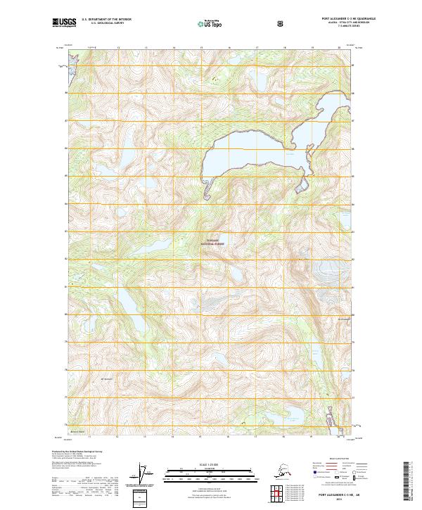
2021 Map of Port Alexander C-3 NE
USGS Topo · Published 2021About this map
Baranof Island presents a landscape defined by dramatic elevation changes and significant water bodies within the Tongass National Forest. The geography is anchored by prominent peaks including Mt Ada, Mt Elizabeth, and Mt Yanovski, which overlook a series of interior lakes and coastal indentations. The most significant coastal feature is Gut Bay, which carves deep into the island's eastern coastline, providing a protected marine environment.
Find a feature on this map
13 named features on this map. Tap any name to fly to it.
Don’t see what you’re looking for? This feature index may not catch every label — zoom into the map to look around manually.
Map Details
Editions of this 2021 Port Alexander C-3 NE Map
This is the sole edition of this map. No revisions or reprints were ever made.
Other maps of this area

1951 · Port Alexander C-2
USGS Topo · 1:63,360

1951 · Port Alexander C-3
USGS Topo · 1:63,360

1951 · Port Alexander D-3
USGS Topo · 1:63,360

1951 · Port Alexander
USGS Topo · 1:250,000

1951 · Port Alexander D-2
USGS Topo · 1:63,360

1952 · Port Alexander
USGS Topo · 1:250,000

1964 · Port Alexander
USGS Topo · 1:250,000

1994 · Port Alexander C-3
USGS Topo · 1:63,360
1995 · Port Alexander D-3
USGS Topo · 1:63,360
1995 · Port Alexander D-2
USGS Topo · 1:63,360