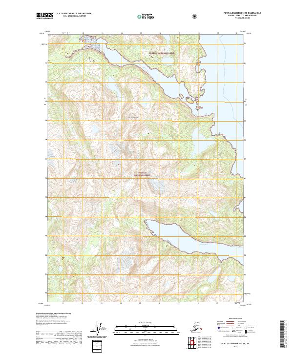
2021 Map of Port Alexander D-3 SE
USGS Topo · Published 2021About this map
Red Bluff Bay and Hoggatt Bay carve deeply into the coastal terrain of Baranof Island, defining the topography of this portion of the Tongass National Forest. The map illustrates a landscape dominated by dramatic elevation changes, with Mt Harding serving as a primary interior landmark. This 2021 edition provides a contemporary record of the coastline and forest boundaries within the Sitka City and Borough, documenting the intricate system of inlets and steep slopes that characterize this maritime environment. While largely devoid of human settlements or road infrastructure, the map details the precise township and range divisions, such as t58s r67e and t59s r68e, which are essential for navigating and managing these protected lands.
Find a feature on this map
9 named features on this map. Tap any name to fly to it.
Don’t see what you’re looking for? This feature index may not catch every label — zoom into the map to look around manually.
Map Details
Editions of this 2021 Port Alexander D-3 SE Map
This is the sole edition of this map. No revisions or reprints were ever made.
Other maps of this area

1951 · Port Alexander C-2
USGS Topo · 1:63,360

1951 · Port Alexander C-3
USGS Topo · 1:63,360

1951 · Port Alexander D-3
USGS Topo · 1:63,360

1951 · Port Alexander
USGS Topo · 1:250,000

1951 · Port Alexander D-2
USGS Topo · 1:63,360

1952 · Port Alexander
USGS Topo · 1:250,000

1964 · Port Alexander
USGS Topo · 1:250,000

1994 · Port Alexander C-3
USGS Topo · 1:63,360
1995 · Port Alexander D-3
USGS Topo · 1:63,360
1995 · Port Alexander D-2
USGS Topo · 1:63,360