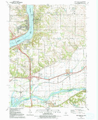
1991 Map of Port Byron
USGS Topo · Published 1992About this map
Port Byron and Le Claire anchor this stretch of the Mississippi River during the early 1990s, where the river serves as both a natural border and a focal point for settlement. The landscape is marked by the convergence of the Rock River and Zuma Creek in the south, creating a complex network of waterways that defined the growth of Barstow, Cleveland, and Osborn. This era shows a well-established infrastructure of schools and churches, including Riverdale High Sch and the First United Ch, serving communities that expanded into the uplands away from the floodplains.
Find a feature on this map
39 named features on this map. Tap any name to fly to it.
Don’t see what you’re looking for? This feature index may not catch every label — zoom into the map to look around manually.
Map Details
Editions of this 1991 Port Byron Map
This is the sole edition of this map. No revisions or reprints were ever made.
Other maps of this area

1892 · Leclaire
USGS Topo · 1:62,500

1893 · Leclaire
USGS Topo · 1:62,500

1899 · Clinton
USGS Topo · 1:125,000

1934 · Geneseo
USGS Topo · 1:62,500

1937 · Orion
USGS Topo · 1:62,500

1949 · Coal Valley
USGS Topo · 1:24,000

1949 · Silvis
USGS Topo · 1:24,000

1949 · Port Byron
USGS Topo · 1:24,000

1950 · Port Byron
USGS Topo · 1:24,000

1952 · Erie
USGS Topo · 1:62,500