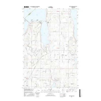
2017 Map of Port Gamble
USGS Topo · Published 2017About this map
Port Gamble and Little Boston face one another across the eponymous bay on the northern tip of the Manette Penninsula. This coastal landscape is defined by its maritime orientation, with the Hood Canal Floating Brg providing a critical connection between Kitsap Co and Jefferson Co just west of Salsbury Point. The interior terrain is crisscrossed by an extensive network of forestry and service roads, including the Port Gamble Loop and various numbered tracks such as Service Road 1000, which weave through the timberlands. To the east, the community of Kingston serves as a local hub near Appletree Cove, while the southern reaches extend toward the waterfront settlement of Indianola on Miller Bay. This era shows a complex mix of tribal lands, historic mill town sites, and modern residential growth, with landmarks like the Buena Vista Cem and Thompson Airport providing essential points of reference for local genealogy and history.
Find a feature on this map
142 named features on this map. Tap any name to fly to it.
Don’t see what you’re looking for? This feature index may not catch every label — zoom into the map to look around manually.
Map Details
Editions of this 2017 Port Gamble Map
This is the sole edition of this map. No revisions or reprints were ever made.
Other maps of this area

1894 · Seattle
USGS Topo · 1:62,500

1895 · Snohomish
USGS Topo · 1:125,000

1897 · Seattle
USGS Topo · 1:125,000

1908 · Seattle
USGS Topo · 1:62,500

1909 · Seattle Special
USGS Topo · 1:62,500

1937 · Port Orchard
USGS Topo · 1:62,500

1937 · Port Gamble
USGS Topo · 1:62,500

1940 · Port Gamble
USGS Topo · 1:62,500

1942 · Edmonds
USGS Topo · 1:62,500

1949 · Shilshole Bay
USGS Topo · 1:24,000