
Loading...
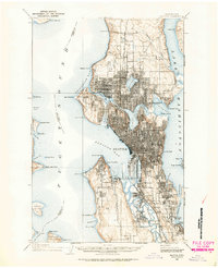
Loading map...1908 Map of Seattle
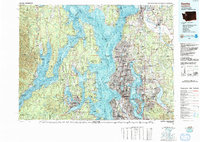
USGS Topo · Published 1955About this map
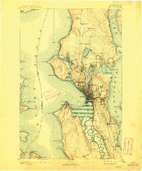
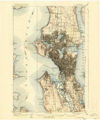
Seattle and its surrounding shorelines are depicted here during a pivotal era of urban expansion and civic planning. The city's geography is defined by its complex waterways, from the Puget Sound and Elliott Bay to the inland waters of Lake Washington and Lake Union. A major focal point is the Alaska-Yukon-Pacific Exposition grounds adjacent to the State University, representing a moment of significant international prominence for the region.
Find a feature on this map
78 named features on this map. Tap any name to fly to it.
Don’t see what you’re looking for? This feature index may not catch every label — zoom into the map to look around manually.
Map Details
Date Portrayed1908
Date Published1955
PublisherU.S. Geological Survey
Map TypeTopographic
Scale1:62,500
Physical Dimensions17 x 21 inches
Editions of this 1908 Seattle Map
2 editions found
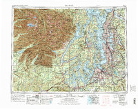
Historical Maps of Seattle Through Time
7 maps found


Featured Locations
Source Details
SourceU.S. Geological Survey
CopyrightPublic Domain