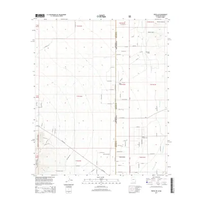
2014 Map of Portal NE
USGS Topo · Published 2014About this map
The San Simon Valley straddles the high-desert borderlands of Arizona and New Mexico, defined by the seasonal flow of the San Simon River and the rugged drainage of Cave Cr. This 2014 survey documents a unique intersection of aviation and wilderness, featuring several specialized airfields such as Amigos Del Cielo Airport and Lizzy Lizard Airport alongside the Rodeo Airport. To the west, the landscape rises into the protected reaches of the Coronado National Forest, where steep access routes like W Portal Peak Rd and S Bear Mountain Rd provide entry to the mountain terrain.
Find a feature on this map
78 named features on this map. Tap any name to fly to it.
Don’t see what you’re looking for? This feature index may not catch every label — zoom into the map to look around manually.
Map Details
Editions of this 2014 Portal NE Map
This is the sole edition of this map. No revisions or reprints were ever made.
Other maps of this area

1917 · San Simon
USGS Topo · 1:125,000

1917 · Chiricahua
USGS Topo · 1:125,000

1918 · Pratt
USGS Topo · 1:62,500

1919 · Pratt
USGS Topo · 1:62,500

1919 · Chiricahua
USGS Topo · 1:125,000

1926 · Rodeo
USGS Topo · 1:62,500

1928 · Chenoweth
USGS Topo · 1:62,500

1950 · Vanar
USGS Topo · 1:62,500

1951 · Vanar
USGS Topo · 1:62,500

1954 · Silver City
USGS Topo · 1:250,000