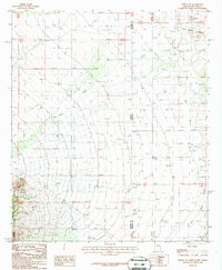
1987 Map of Portal NE
USGS Topo · Published 1987About this map
The Chiricahua National Forest and Chiricahua Wilderness define the western portion of this 1980s landscape, where the high terrain of the Chiricahua Mountains meets the arid basin floor. The boundary between Arizona and New Mexico bisects the quadrangle, with the border crossing noted by Mon 35. This desert environment is shaped by water management and resource extraction, evidenced by several wells, a Check Dam, and a Mine Shaft located east of the San Simon River.
Find a feature on this map
27 named features on this map. Tap any name to fly to it.
Don’t see what you’re looking for? This feature index may not catch every label — zoom into the map to look around manually.
Map Details
Editions of this 1987 Portal NE Map
This is the sole edition of this map. No revisions or reprints were ever made.
Other maps of this area

1917 · San Simon
USGS Topo · 1:125,000

1917 · Chiricahua
USGS Topo · 1:125,000

1918 · Pratt
USGS Topo · 1:62,500

1919 · Pratt
USGS Topo · 1:62,500

1919 · Chiricahua
USGS Topo · 1:125,000

1926 · Rodeo
USGS Topo · 1:62,500

1928 · Chenoweth
USGS Topo · 1:62,500

1950 · Vanar
USGS Topo · 1:62,500

1951 · Vanar
USGS Topo · 1:62,500

1954 · Silver City
USGS Topo · 1:250,000