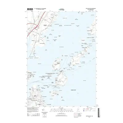
2014 Map of Portland East
USGS Topo · Published 2014About this map
Casco Bay and its intricate network of islands define this coastal Maine landscape, dominated by a formidable legacy of maritime defense. Significant coastal fortifications, including Fort Gorges in the harbor and Fort Preble on the mainland, stand as markers of the region's military importance. Further out, Fort Levett on Cushing Island and Fort Scammel on House Island protected the approaches to the port. On the mainland, the residential character of Falmouth Foreside and Ferry Village contrasts with the dense urban edge of the East End. Genealogists may find value in the various burial grounds documented, such as Eastern Cem and Old Settlers Cem, while the island settlements at Peaks Island and Trefethen illustrate the enduring community structures of the Maine coast.
Find a feature on this map
228 named features on this map. Tap any name to fly to it.
Don’t see what you’re looking for? This feature index may not catch every label — zoom into the map to look around manually.
Map Details
Editions of this 2014 Portland East Map
This is the sole edition of this map. No revisions or reprints were ever made.
Other maps of this area

1891 · Portland
USGS Topo · 1:62,500

1892 · Freeport
USGS Topo · 1:62,500

1893 · Portland
USGS Topo · 1:62,500

1893 · Casco Bay
USGS Topo · 1:62,500

1894 · Gray
USGS Topo · 1:62,500

1898 · Gray
USGS Topo · 1:62,500

1914 · Portland
USGS Topo · 1:48,000

1914 · Casco Bay
USGS Topo · 1:48,000

1916 · Portland
USGS Topo · 1:62,500

1916 · Casco Bay
USGS Topo · 1:62,500