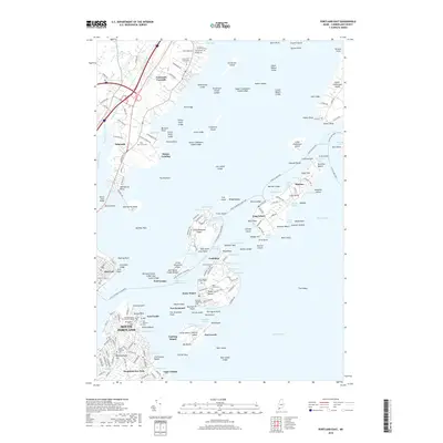
2018 Map of Portland East
USGS Topo · Published 2018About this map
Fort Preble and Fort Scammel anchor the coastal defenses of Portland Harbor, marking a landscape defined by its strategic military history and island geography. This 2018 survey details the intricate shoreline from South Portland up to Falmouth Foreside, capturing the dense cluster of islands including Great Chebeague Island, Long Island, and Cushing Island. The map is a vital resource for genealogists and local historians, pinpointing multiple burial sites such as the Foreside Community Cem and the Old Settlers Cem near Willard Beach. The transition from the urban grid of East End and City Point to the summer colonies and coves like Mussel Cove and Broad Cove illustrates the enduring maritime character of Casco Bay. Residential developments on the mainland around Meetinghouse Hill and Mountainview Park contrast with the largely water-accessible landmarks like Fort Gorges and Fort Levett.
Find a feature on this map
220 named features on this map. Tap any name to fly to it.
Don’t see what you’re looking for? This feature index may not catch every label — zoom into the map to look around manually.
Map Details
Editions of this 2018 Portland East Map
This is the sole edition of this map. No revisions or reprints were ever made.
Other maps of this area

1891 · Portland
USGS Topo · 1:62,500

1892 · Freeport
USGS Topo · 1:62,500

1893 · Portland
USGS Topo · 1:62,500

1893 · Casco Bay
USGS Topo · 1:62,500

1894 · Gray
USGS Topo · 1:62,500

1898 · Gray
USGS Topo · 1:62,500

1914 · Portland
USGS Topo · 1:48,000

1914 · Casco Bay
USGS Topo · 1:48,000

1916 · Portland
USGS Topo · 1:62,500

1916 · Casco Bay
USGS Topo · 1:62,500