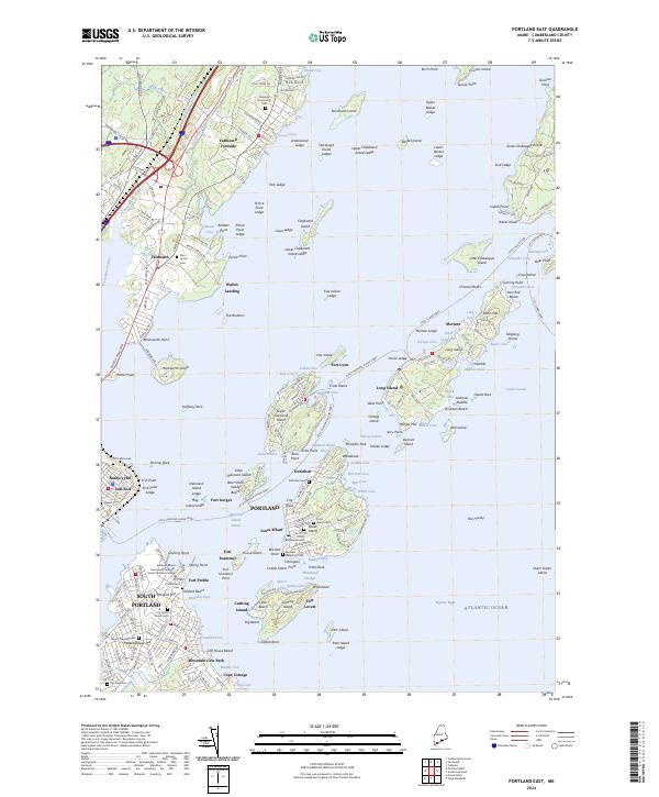
2024 Map of Portland East
USGS Topo · Published 2024About this map
Casco Bay is defined by a dense constellation of coastal fortifications and maritime transit lines that connect Portland to its outlying islands. Defensive history is layered across the harbor, marked by coastal batteries and fortifications such as Fort Gorges, Fort Preble, and Fort Levett, reflecting the strategic military importance of this Maine coastline across multiple centuries. On the mainland, the map details established neighborhoods like South Portland and Falmouth Foreside, where family and community history is preserved in sites like the Eastern Cem and Foreside Community Cem.
Find a feature on this map
227 named features on this map. Tap any name to fly to it.
Don’t see what you’re looking for? This feature index may not catch every label — zoom into the map to look around manually.
Map Details
Editions of this 2024 Portland East Map
This is the sole edition of this map. No revisions or reprints were ever made.
Other maps of this area

1891 · Portland
USGS Topo · 1:62,500

1892 · Freeport
USGS Topo · 1:62,500

1893 · Portland
USGS Topo · 1:62,500

1893 · Casco Bay
USGS Topo · 1:62,500

1894 · Gray
USGS Topo · 1:62,500

1898 · Gray
USGS Topo · 1:62,500

1914 · Portland
USGS Topo · 1:48,000

1914 · Casco Bay
USGS Topo · 1:48,000

1916 · Portland
USGS Topo · 1:62,500

1916 · Casco Bay
USGS Topo · 1:62,500