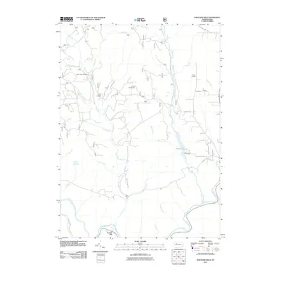
2011 Map of Portland Mills
USGS Topo · Published 2011About this map
Portland Mills serves as the focal point of this Elk County landscape, situated where the Clarion River meets its southern tributaries. The terrain is defined by a dense network of waterways including Big Mill Creek, Bear Creek, and the Ridgway Reservoir, reflecting a region shaped by both its natural hydrology and industrial utility. Resource extraction is evident at the Bear Creek Gas Field, while the Round Top Fire Tower stands as a sentinel over the surrounding woodland. The eastern portion of the map reveals local community landmarks such as the Ott Cemetery and Kings Airfield. From the historic Norton Dam to the namesake settlement, the map provides a detailed view of the infrastructure and land use patterns that have defined this part of Pennsylvania's northern plateau into the twenty-first century.
Find a feature on this map
44 named features on this map. Tap any name to fly to it.
Don’t see what you’re looking for? This feature index may not catch every label — zoom into the map to look around manually.
Map Details
Editions of this 2011 Portland Mills Map
This is the sole edition of this map. No revisions or reprints were ever made.
Other maps of this area

1934 · Kane
USGS Topo · 1:48,000

1935 · Mt. Jewett
USGS Topo · 1:48,000

1939 · Kane
USGS Topo · 1:62,500

1940 · Hallton
USGS Topo · 1:48,000

1940 · Mt. Jewett
USGS Topo · 1:62,500

1941 · Ridgway
USGS Topo · 1:62,500

1943 · Hallton
USGS Topo · 1:62,500

1944 · Ridgway
USGS Topo · 1:62,500

1957 · Warren
USGS Topo · 1:250,000

1958 · Warren
USGS Topo · 1:250,000
Featured Places
- Spring Creek Township, PA
- Portland Mills, Spring Creek Township
- Highland Township, PA
- Ridgway Township, PA
- Elk County, PA