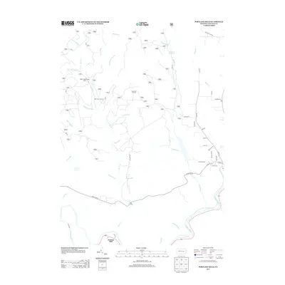
2013 Map of Portland Mills
USGS Topo · Published 2013About this map
Portland Mills sits at the southern edge of this map, positioned where Bear Creek meets the Clarion River. This 2013 survey reveals a landscape largely defined by the forest and its resources, featuring the Bear Creek Gas Field and the Round Top Fire Tower overlooking the drainage of Little Otter Cr. The northern reaches are characterized by the Ridgway Reservoir and a complex network of forest roads like Old Red Mill Dam Rd, reflecting a region managed for both water supply and outdoor recreation. Waterways such as Big Mill Cr and Windfall Run carve through the terrain, while the Bear Creek Picnic Area serves as a localized landmark for those navigating the valley near Italian Shanty Run.
Find a feature on this map
46 named features on this map. Tap any name to fly to it.
Don’t see what you’re looking for? This feature index may not catch every label — zoom into the map to look around manually.
Map Details
Editions of this 2013 Portland Mills Map
This is the sole edition of this map. No revisions or reprints were ever made.
Other maps of this area

1934 · Kane
USGS Topo · 1:48,000

1935 · Mt. Jewett
USGS Topo · 1:48,000

1939 · Kane
USGS Topo · 1:62,500

1940 · Hallton
USGS Topo · 1:48,000

1940 · Mt. Jewett
USGS Topo · 1:62,500

1941 · Ridgway
USGS Topo · 1:62,500

1943 · Hallton
USGS Topo · 1:62,500

1944 · Ridgway
USGS Topo · 1:62,500

1957 · Warren
USGS Topo · 1:250,000

1958 · Warren
USGS Topo · 1:250,000
Featured Places
- Spring Creek Township, PA
- Portland Mills, Spring Creek Township
- Highland Township, PA
- Ridgway Township, PA
- Elk County, PA