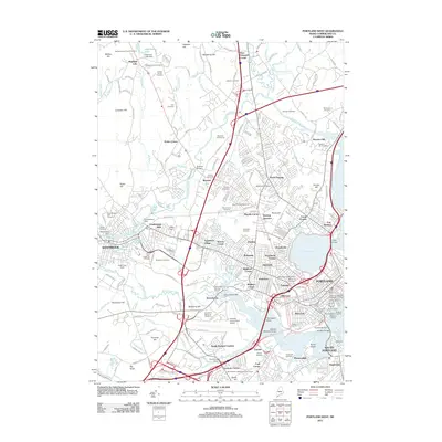
2011 Map of Portland West
USGS Topo · Published 2011About this map
Portland and its western suburbs in the early 21st century reveal a landscape where historic industrial roots and modern transit hubs overlap. The Presumpscot River snakes through the northern reach, passing through Cumberland Mills and over the Saccarappa Dam, reflecting the area's long-standing reliance on water power for milling. Further south, the expansive grounds of the Portland International Jetport dominate the terrain near Stroudwater, an area still marked by its historic Stroudwater Burying Ground.
Find a feature on this map
251 named features on this map. Tap any name to fly to it.
Don’t see what you’re looking for? This feature index may not catch every label — zoom into the map to look around manually.
Map Details
Editions of this 2011 Portland West Map
This is the sole edition of this map. No revisions or reprints were ever made.
Other maps of this area

1891 · Portland
USGS Topo · 1:62,500

1892 · Freeport
USGS Topo · 1:62,500

1893 · Portland
USGS Topo · 1:62,500

1893 · Casco Bay
USGS Topo · 1:62,500

1894 · Gray
USGS Topo · 1:62,500

1898 · Gray
USGS Topo · 1:62,500

1914 · Portland
USGS Topo · 1:48,000

1914 · Casco Bay
USGS Topo · 1:48,000

1916 · Portland
USGS Topo · 1:62,500

1916 · Casco Bay
USGS Topo · 1:62,500