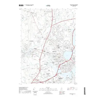
2018 Map of Portland West
USGS Topo · Published 2018About this map
The Presumpscot River winds through this detailed survey of Portland's western reaches, marking the boundary between established industrial centers like Westbrook and the expanding residential neighborhoods of Deering. In the early 21st century, the landscape reflects a complex layering of history, where the modern Portland International Jetport sits adjacent to the 18th-century Stroudwater Burying Ground. The map reveals the deep-rooted family legacy of the region through numerous small plots such as the Pride Family Cem and Gowen Family Cem. Educational and religious institutions are prominent, including the University of New England Westbrook College and several Jewish burial grounds like Mount Sinai Cem. Industrial heritage is preserved in the labels for Cumberland Mills and the Grand Trunk Cem, highlighting the era when rail and water power drove the local economy.
Find a feature on this map
343 named features on this map. Tap any name to fly to it.
Don’t see what you’re looking for? This feature index may not catch every label — zoom into the map to look around manually.
Map Details
Editions of this 2018 Portland West Map
This is the sole edition of this map. No revisions or reprints were ever made.
Other maps of this area

1891 · Portland
USGS Topo · 1:62,500

1892 · Freeport
USGS Topo · 1:62,500

1893 · Portland
USGS Topo · 1:62,500

1893 · Casco Bay
USGS Topo · 1:62,500

1894 · Gray
USGS Topo · 1:62,500

1898 · Gray
USGS Topo · 1:62,500

1914 · Portland
USGS Topo · 1:48,000

1914 · Casco Bay
USGS Topo · 1:48,000

1916 · Portland
USGS Topo · 1:62,500

1916 · Casco Bay
USGS Topo · 1:62,500