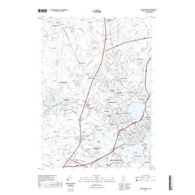
2021 Map of Portland West
USGS Topo · Published 2021About this map
Portland and the neighboring industrial hub of Westbrook anchor this coastal Maine landscape, where the Presumpscot River winds toward the Atlantic. The river's historical importance is marked by features like Presumpscot Falls and Succarappa Falls, once power sources for the mills that shaped local development. The map details the dense neighborhoods of the West End, Munjoy Hill, and East End, alongside the waterfront docks along Fore River. Educational and civic institutions are prominent, including the University of Southern Maine and the Maine Supreme Judicial Court. Beyond the urban core, the map reveals a complex network of cemeteries and burial grounds like Evergreen Cem and the Stroudwater Burying Ground Cem, which serve as vital touchstones for family historians. From the busy runways of the Portland International Jetport to the tidal reaches of Back Cove, this survey captures the intersection of Maine's maritime heritage and modern infrastructure.
Find a feature on this map
119 named features on this map. Tap any name to fly to it.
Don’t see what you’re looking for? This feature index may not catch every label — zoom into the map to look around manually.
Map Details
Editions of this 2021 Portland West Map
This is the sole edition of this map. No revisions or reprints were ever made.
Other maps of this area

1891 · Portland
USGS Topo · 1:62,500

1892 · Freeport
USGS Topo · 1:62,500

1893 · Portland
USGS Topo · 1:62,500

1893 · Casco Bay
USGS Topo · 1:62,500

1894 · Gray
USGS Topo · 1:62,500

1898 · Gray
USGS Topo · 1:62,500

1914 · Portland
USGS Topo · 1:48,000

1914 · Casco Bay
USGS Topo · 1:48,000

1916 · Portland
USGS Topo · 1:62,500

1916 · Casco Bay
USGS Topo · 1:62,500