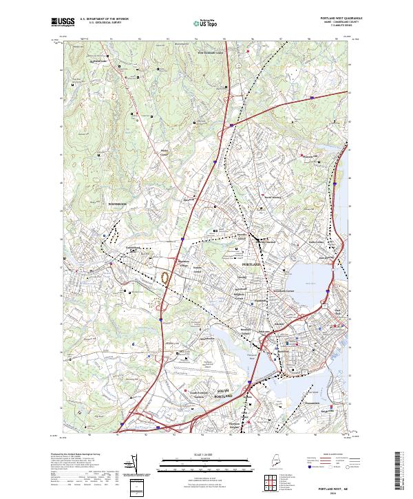
2024 Map of Portland West
USGS Topo · Published 2024About this map
The Heath and several major hills like Blackstrap Hill and Rocky Hill define the western approach to this coastal corridor, where the Presumpscot River and Stroudwater River flow toward the Atlantic. The landscape reflects a dense concentration of early burying grounds and municipal centers, including the historic Stroudwater Burying Ground Cem and the Cumberland County Courthouse. Industrial and residential development is anchored by Cumberland Mills and Westbrook, radiating outward through neighborhood nodes like Morrills Corner, Woodfords Corner, and Deering Junction. The map captures the significant footprint of the Portland International Jetport alongside academic institutions such as the University of Southern Maine and the University of New England Westbrook College. This coastal survey documents the transition from the upland woods of Prides Corner to the busy urban waterfront at Back Cove and the Fore River.
Find a feature on this map
120 named features on this map. Tap any name to fly to it.
Don’t see what you’re looking for? This feature index may not catch every label — zoom into the map to look around manually.
Map Details
Editions of this 2024 Portland West Map
This is the sole edition of this map. No revisions or reprints were ever made.
Other maps of this area

1891 · Portland
USGS Topo · 1:62,500

1892 · Freeport
USGS Topo · 1:62,500

1893 · Portland
USGS Topo · 1:62,500

1893 · Casco Bay
USGS Topo · 1:62,500

1894 · Gray
USGS Topo · 1:62,500

1898 · Gray
USGS Topo · 1:62,500

1914 · Portland
USGS Topo · 1:48,000

1914 · Casco Bay
USGS Topo · 1:48,000

1916 · Portland
USGS Topo · 1:62,500

1916 · Casco Bay
USGS Topo · 1:62,500