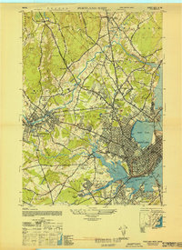
1944 Map of Portland West
USGS Topo · Published 1948About this map
Industrial corridors and residential expansion define the landscape west of Portland just as the Second World War concluded. The Maine Central and Grand Trunk railroads anchor the local economy, connecting urban centers like Woodfords and Deering with outlying industrial nodes such as Cumberland Mills. To the south, the Portland Airport and the State Reform School occupy large tracts of land near the winding Long Creek.
Find a feature on this map
87 named features on this map. Tap any name to fly to it.
Don’t see what you’re looking for? This feature index may not catch every label — zoom into the map to look around manually.
Map Details
Editions of this 1944 Portland West Map
This is the sole edition of this map. No revisions or reprints were ever made.
Other maps of this area

1891 · Portland
USGS Topo · 1:62,500

1892 · Freeport
USGS Topo · 1:62,500

1893 · Portland
USGS Topo · 1:62,500

1893 · Casco Bay
USGS Topo · 1:62,500

1894 · Gray
USGS Topo · 1:62,500

1898 · Gray
USGS Topo · 1:62,500

1914 · Portland
USGS Topo · 1:48,000

1914 · Casco Bay
USGS Topo · 1:48,000

1916 · Portland
USGS Topo · 1:62,500

1916 · Casco Bay
USGS Topo · 1:62,500