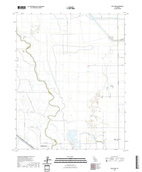
2021 Map of Poso Farm
USGS Topo · Published 2021About this map
The San Joaquin River snakes through this agricultural landscape, forming the natural boundary between Fresno and Madera Counties. This section of the Central San Joaquin Valley is defined by a sophisticated network of water management, where natural features like Berenda Slough, Lone Willow Slough, and Buttonwillow Slough interface with engineered systems. To the west, the Poso Canal, Central Canal, and numerous drainage channels such as Poso Drain One support the intense cultivation of the valley floor. In the southwest corner, the map reaches the outskirts of Firebaugh, showing the intersection of Main St and N Dos Palos Rd near the River Br Columbia Canal. The grid of rural roads, including Triangle T Rd and Hemlock Rd, illustrates the organized expansion of ranching and farming operations across this fertile alluvial plain.
Find a feature on this map
39 named features on this map. Tap any name to fly to it.
Don’t see what you’re looking for? This feature index may not catch every label — zoom into the map to look around manually.
Map Details
Editions of this 2021 Poso Farm Map
This is the sole edition of this map. No revisions or reprints were ever made.
Other maps of this area

1913 · Panoche
USGS Topo · 1:125,000

1916 · Santa Rita Bridge
USGS Topo · 1:24,000

1918 · Bliss Ranch
USGS Topo · 1:31,680

1918 · Chowchilla
USGS Topo · 1:31,680

1920 · Santa Rita Bridge
USGS Topo · 1:31,680

1921 · Mendota
USGS Topo · 1:31,680

1922 · Oxalis
USGS Topo · 1:31,680

1922 · Santa Rita Bridge
USGS Topo · 1:31,680

1922 · Pozo Farm
USGS Topo · 1:31,680

1922 · Kentucky Well
USGS Topo · 1:31,680