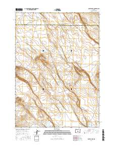
2017 Map of Potato Lake
USGS Topo · Published 2017About this map
High desert basins and ephemeral hydrology define this portion of the Oregon landscape along the border of Deschutes Co and Lake Co. The central feature, Potato Lake, sits in a shallow depression surrounded by a network of intermittent water bodies including Browns Lake and Jones Lake. This area represents a classic basin-and-range topography where the land rises toward Studhorse Butte in the west and Parmele Ridge to the east. These geological features influence the local drainage patterns that feed into seasonal flats like Ant Flat and Perry Flat. Modern cartography from the U.S. Geological Survey shows the complex contours of the volcanic terrain, capturing the precise boundaries of public land survey townships including t23s r21e and t23s r22e.
Find a feature on this map
16 named features on this map. Tap any name to fly to it.
Don’t see what you’re looking for? This feature index may not catch every label — zoom into the map to look around manually.
Map Details
Editions of this 2017 Potato Lake Map
This is the sole edition of this map. No revisions or reprints were ever made.
Other maps of this area

1955 · Crescent
USGS Topo · 1:250,000

1957 · Crescent
USGS Topo · 1:250,000

1958 · Crescent
USGS Topo · 1:250,000

1970 · Crescent
USGS Topo · 1:250,000
1981 · Tired Horse Butte
USGS Topo · 1:24,000

1981 · Moonlight Butte
USGS Topo · 1:24,000

1981 · Chicago Valley
USGS Topo · 1:24,000

1983 · Potato Lake
USGS Topo · 1:24,000

1983 · Benjamin Lake
USGS Topo · 1:24,000

1983 · West of Hampton
USGS Topo · 1:24,000