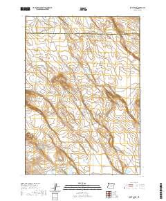
2020 Map of Potato Lake
USGS Topo · Published 2020About this map
Potato Lake and a series of ephemeral basins dot this high-desert landscape along the border of Deschutes Co and Lake Co. The terrain is characterized by broad expanses such as Canary Flat and Perry Flat, punctuated by topographical rises like Studhorse Butte and the elongated Parmele Ridge. This survey illustrates a remote portion of Central Oregon where water is scarce and seasonal, as seen in the drainage patterns of Jones Lake and Hassler Lake to the south. The grid of the Public Land Survey System divides the region into townships such as t23s r21e, reflecting the systematic allocation of this open range. This map is particularly useful for understanding the natural landforms and traditional livestock grazing areas in this quiet corner of the state.
Find a feature on this map
15 named features on this map. Tap any name to fly to it.
Don’t see what you’re looking for? This feature index may not catch every label — zoom into the map to look around manually.
Map Details
Editions of this 2020 Potato Lake Map
This is the sole edition of this map. No revisions or reprints were ever made.
Other maps of this area

1955 · Crescent
USGS Topo · 1:250,000

1957 · Crescent
USGS Topo · 1:250,000

1958 · Crescent
USGS Topo · 1:250,000

1970 · Crescent
USGS Topo · 1:250,000
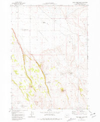
1981 · Tired Horse Butte
USGS Topo · 1:24,000

1981 · Moonlight Butte
USGS Topo · 1:24,000

1981 · Chicago Valley
USGS Topo · 1:24,000

1983 · Potato Lake
USGS Topo · 1:24,000

1983 · Benjamin Lake
USGS Topo · 1:24,000

1983 · West of Hampton
USGS Topo · 1:24,000