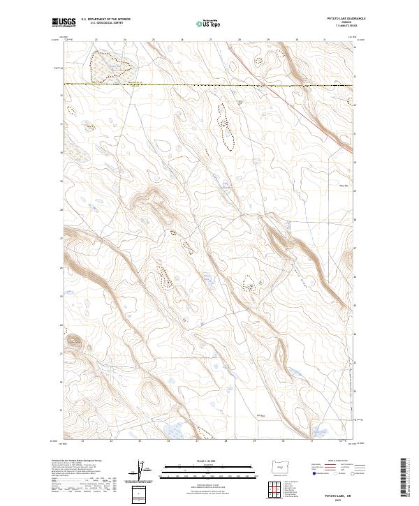
2023 Map of Potato Lake
USGS Topo · Published 2023About this map
Ant Flat lies at the southern edge of this Lake County landscape, where the high desert terrain transitions between open basins and distinct volcanic rises. The area is defined by a series of intermittent water bodies including Potato Lake, Jones Lake, and Hussler Lake, which serve as vital landmarks in this arid environment. The topography is marked by significant elevations such as Studhorse Butte in the southwest and the elongated Parmele Ridge that trends northwest to southeast across the central sections. This U.S. Geological Survey representation traces the county boundary between Deschutes Co and Lake Co as it crosses the northern reaches near Canary Flat. The map provides a detailed view of the township and range grid system, illustrating the vast, unpopulated character of the High Desert during the early 21st century.
Find a feature on this map
16 named features on this map. Tap any name to fly to it.
Don’t see what you’re looking for? This feature index may not catch every label — zoom into the map to look around manually.
Map Details
Editions of this 2023 Potato Lake Map
This is the sole edition of this map. No revisions or reprints were ever made.
Other maps of this area

1955 · Crescent
USGS Topo · 1:250,000

1957 · Crescent
USGS Topo · 1:250,000

1958 · Crescent
USGS Topo · 1:250,000

1970 · Crescent
USGS Topo · 1:250,000
1981 · Tired Horse Butte
USGS Topo · 1:24,000

1981 · Moonlight Butte
USGS Topo · 1:24,000

1981 · Chicago Valley
USGS Topo · 1:24,000

1983 · Potato Lake
USGS Topo · 1:24,000

1983 · Benjamin Lake
USGS Topo · 1:24,000

1983 · West of Hampton
USGS Topo · 1:24,000