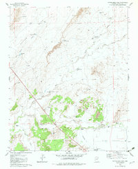
1982 Map of Potter Mesa Tank
USGS Topo · Published 1983About this map
The confluence of the Little Colorado River and the Zuni River defines this high-desert landscape in Apache County, where water management is the primary driver of human activity. Published in the early 1980s, the map reveals an intricate network of stock tanks and wells necessary for ranching across Potter Mesa and the surrounding draws. Significant infrastructure such as the Rock Crossing Windmill and the Gaging Station near the river forks illustrate the importance of water monitoring in this arid environment.
Find a feature on this map
30 named features on this map. Tap any name to fly to it.
Don’t see what you’re looking for? This feature index may not catch every label — zoom into the map to look around manually.
Map Details
Editions of this 1982 Potter Mesa Tank Map
This is the sole edition of this map. No revisions or reprints were ever made.
Other maps of this area

1886 · St Johns
USGS Topo · 1:250,000

1892 · St Johns
USGS Topo · 1:250,000

1912 · Petrified Forest
USGS Topo · 1:62,500

1954 · Saint Johns
USGS Topo · 1:250,000

1955 · Petrified Forest
USGS Topo · 1:62,500

1955 · Adamana 1 SW
USGS Topo · 1:24,000

1955 · Adamana 3 NE
USGS Topo · 1:24,000

1955 · Adamana 4 SW
USGS Topo · 1:24,000

1955 · Adamana 4 NE
USGS Topo · 1:24,000

1955 · Adamana 4 NW
USGS Topo · 1:24,000