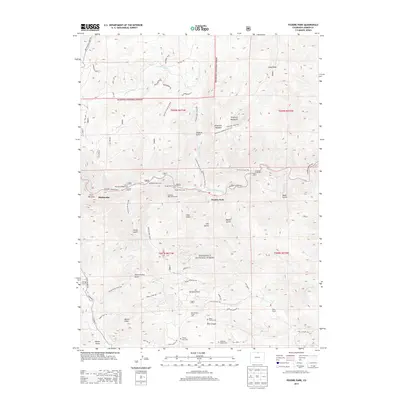
2013 Map of Poudre Park
USGS Topo · Published 2013About this map
The Cache la Poudre River carves a central corridor through this section of the Roosevelt National Forest, where the canyon landscape dictates the pattern of human settlement. Modern infrastructure follows the water, with the Poudre Canyon Hwy linking small communities like Poudre Park and Mishawaka. The map records several private landmarks and family heritage sites, including the Bania Family Cem and Williams Family Cem near Rist Canyon, and the Dilky Ranch further east. High points like Greyrock Mountain and Mount Ethel tower over a network of drainage gulches and trails, such as the Young Gulch Trail 999 and Hewlett Gulch Trail 954. This documentation of the canyon corridor captures the balance between forest recreation sites, such as the Diamond Rock Picnic Area, and the enduring presence of mountain ranching and family homesteads.
Find a feature on this map
61 named features on this map. Tap any name to fly to it.
Don’t see what you’re looking for? This feature index may not catch every label — zoom into the map to look around manually.
Map Details
Editions of this 2013 Poudre Park Map
This is the sole edition of this map. No revisions or reprints were ever made.
Other maps of this area

1906 · Fort Collins
USGS Topo · 1:62,500

1907 · Livermore
USGS Topo · 1:125,000

1908 · Fort Collins
USGS Topo · 1:62,500

1909 · Livermore
USGS Topo · 1:125,000

1954 · Greeley
USGS Topo · 1:250,000

1957 · Greeley
USGS Topo · 1:250,000

1958 · Greeley
USGS Topo · 1:250,000

1960 · Livermore
USGS Topo · 1:24,000

1960 · Haystack Gulch
USGS Topo · 1:24,000

1960 · Livermore Mountain
USGS Topo · 1:24,000