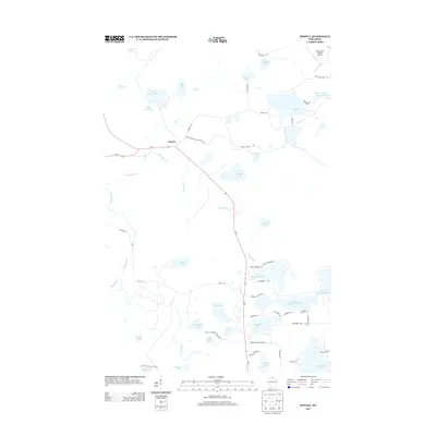
2013 Map of Powell
USGS Topo · Published 2013About this map
The Lac Du Flambeau Indian Res covers much of the southern portion of this landscape, where a dense network of glacial lakes and waterways defines the geography of Vilas County. The small settlement of Powell serves as a central point where Wi-182 and Wi-47 meet, situated near the headwaters of Little Bear Cr. This 2013 survey illustrates a region shaped by water and recreation, featuring prominent bodies such as Dead Pike Lake, Lower Sugarbush Lake, and the winding Bear River. The northern reaches include the Manitowish Waters Airport, while the south is crisscrossed by specialized routes like Sugarbush Trl and Pokegama Lake Trl, reflecting the area's importance as a seasonal and tribal hub. Local landmarks like Muskesin Lake and Signal Lake are connected by a web of local roads, providing a detailed view of property access and land use within the reservation and surrounding marshes.
Find a feature on this map
60 named features on this map. Tap any name to fly to it.
Don’t see what you’re looking for? This feature index may not catch every label — zoom into the map to look around manually.
Map Details
Editions of this 2013 Powell Map
This is the sole edition of this map. No revisions or reprints were ever made.
Other maps of this area

1938 · Lac Du Flambeau
USGS Topo · 1:48,000

1939 · Lac Du Flambeau
USGS Topo · 1:48,000

1939 · Winchester
USGS Topo · 1:48,000

1940 · Mercer
USGS Topo · 1:48,000

1941 · Pike Lake
USGS Topo · 1:48,000

1942 · Pike Lake
USGS Topo · 1:48,000

1945 · Mercer
USGS Topo · 1:48,000

1946 · Winchester
USGS Topo · 1:48,000

1946 · Lac Du Flambeau
USGS Topo · 1:48,000

1947 · Mercer
USGS Topo · 1:48,000