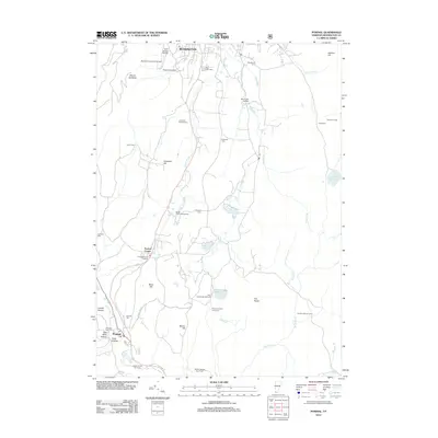
2012 Map of Pownal
USGS Topo · Published 2012About this map
Mount Anthony and Carpenter Hill dominate this portion of the Vermont landscape, where the town of Pownal sits near the winding Hoosic River. This 2012 survey documents a dense network of family history markers, including numerous small burial grounds like the Potter Cem and Reuben Jepson Farm Cem. The map reveals the academic and agricultural footprint of the region, featuring Southern Vermont College and Saint Joseph College alongside established properties such as Shadowbrook Farm. Moving east, the terrain rises toward The Dome and Harmon Hill, separated by a series of waterways including S Stream and Broad Brook. The presence of the Bennington Hatchery and several seasonal sites like the Col Seth Warner Camp illustrate the mix of state infrastructure and recreational use in this corner of Bennington County.
Find a feature on this map
46 named features on this map. Tap any name to fly to it.
Don’t see what you’re looking for? This feature index may not catch every label — zoom into the map to look around manually.
Map Details
Editions of this 2012 Pownal Map
This is the sole edition of this map. No revisions or reprints were ever made.
Other maps of this area

1886 · Greylock
USGS Topo · 1:62,500

1888 · Berlin
USGS Topo · 1:62,500

1890 · Berlin
USGS Topo · 1:62,500

1891 · Greylock
USGS Topo · 1:62,500

1893 · Greylock
USGS Topo · 1:62,500

1894 · Berlin
USGS Topo · 1:62,500

1897 · Hoosick
USGS Topo · 1:62,500

1898 · Berlin
USGS Topo · 1:62,500

1898 · Bennington
USGS Topo · 1:62,500

1898 · Greylock
USGS Topo · 1:62,500