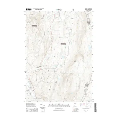
2015 Map of Pownal
USGS Topo · Published 2015About this map
The Green Mountain National Forest dominates much of the eastern and western horizons in this 2015 study, framing a corridor of Vermont history and topography. The Appalachian National Scenic Trail winds through the high ground on the eastern edge, passing landmarks like The Dome and Harmon Hill. In the valley floor, the Hoosic River flows near the settlements of Pownal and Sherman Yard. Genealogists will find a dense concentration of family-named burial sites, including the Joseph Barber Farm Cem, Reuben Jepson Farm Cem, and the Perry Thompson Farm Cem, which point to the deep-rooted agricultural heritage of Bennington County. Near the northern boundary, the campus of Southern Vermont Coll sits at the foot of Mt Anthony, while the local road network, including Old Military Rd, traces the historical movement of people through this valley.
Find a feature on this map
68 named features on this map. Tap any name to fly to it.
Don’t see what you’re looking for? This feature index may not catch every label — zoom into the map to look around manually.
Map Details
Editions of this 2015 Pownal Map
This is the sole edition of this map. No revisions or reprints were ever made.
Other maps of this area

1886 · Greylock
USGS Topo · 1:62,500

1888 · Berlin
USGS Topo · 1:62,500

1890 · Berlin
USGS Topo · 1:62,500

1891 · Greylock
USGS Topo · 1:62,500

1893 · Greylock
USGS Topo · 1:62,500

1894 · Berlin
USGS Topo · 1:62,500

1897 · Hoosick
USGS Topo · 1:62,500

1898 · Berlin
USGS Topo · 1:62,500

1898 · Bennington
USGS Topo · 1:62,500

1898 · Greylock
USGS Topo · 1:62,500