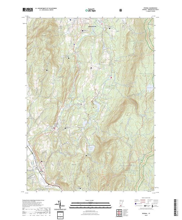
2024 Map of Pownal
USGS Topo · Published 2024About this map
Pownal and Pownal Center anchor this portrait of the southwestern Vermont landscape, where the Taconic Range meets the Green Mountains. The terrain is defined by prominent elevations such as Mt Anthony and The Dome, while the Hoosic River and its tributaries like Jewett Brook carve through the valley floor. The map provides extensive genealogical value through numerous family-named burial sites, including the Perry Thompson Farm Cem and the Reuben Jepson Farm Cem, suggesting a long history of agricultural settlement and persistent land ownership in Bennington County.
Find a feature on this map
101 named features on this map. Tap any name to fly to it.
Don’t see what you’re looking for? This feature index may not catch every label — zoom into the map to look around manually.
Map Details
Editions of this 2024 Pownal Map
This is the sole edition of this map. No revisions or reprints were ever made.
Other maps of this area

1886 · Greylock
USGS Topo · 1:62,500

1888 · Berlin
USGS Topo · 1:62,500

1890 · Berlin
USGS Topo · 1:62,500

1891 · Greylock
USGS Topo · 1:62,500

1893 · Greylock
USGS Topo · 1:62,500

1894 · Berlin
USGS Topo · 1:62,500

1897 · Hoosick
USGS Topo · 1:62,500

1898 · Berlin
USGS Topo · 1:62,500

1898 · Bennington
USGS Topo · 1:62,500

1898 · Greylock
USGS Topo · 1:62,500