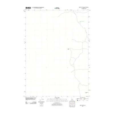
2010 Map of Pratt Butte
USGS Topo · Published 2010About this map
Pratt Butte and Rattlesnake Butte anchor this high-altitude landscape in Blaine County, Idaho, where the volcanic geology of the region is clearly mapped by the U.S. Geological Survey. The terrain is characterized by expansive, open flats punctuated by these isolated volcanic rises, a typical formation within the Snake River Plain volcanic province. Human presence is marked primarily by ranching and water management infrastructure, most notably at Heifer Reservoir in the northeastern corner. Transportation through this arid environment is limited to unpaved routes like Pratt Lake Rd, which winds through the basin to connect the scattered water resources and landmarks. This 2010 survey reflects a modern period of topographic mapping, detailing the subtle drainage patterns and landforms of a sparsely populated but geographically distinct high desert region.
Find a feature on this map
4 named features on this map. Tap any name to fly to it.
Don’t see what you’re looking for? This feature index may not catch every label — zoom into the map to look around manually.
Map Details
Editions of this 2010 Pratt Butte Map
This is the sole edition of this map. No revisions or reprints were ever made.
Other maps of this area

1955 · Idaho Falls
USGS Topo · 1:250,000

1958 · Idaho Falls
USGS Topo · 1:250,000

1972 · Quaking Aspen Butte
USGS Topo · 1:24,000

1972 · Antelope Lake
USGS Topo · 1:24,000

1972 · Pratt Butte
USGS Topo · 1:24,000

1972 · Bear Park East
USGS Topo · 1:24,000

1972 · Bear Park West
USGS Topo · 1:24,000

1972 · Fingers Butte
USGS Topo · 1:24,000

1972 · Serviceberry Butte
USGS Topo · 1:24,000
1973 · Fissure Butte
USGS Topo · 1:24,000