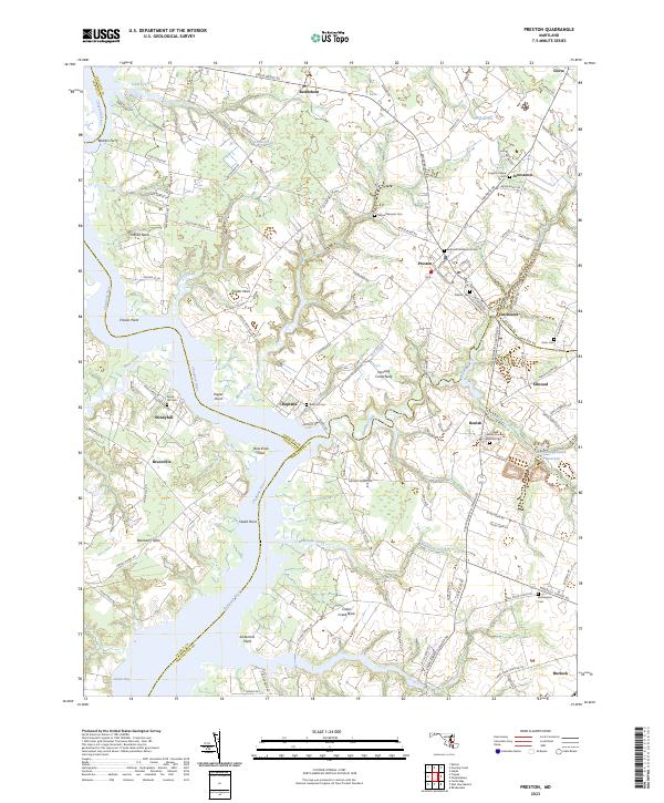
2023 Map of Preston
USGS Topo · Published 2023About this map
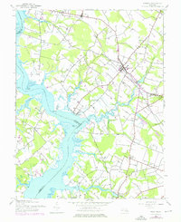
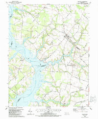
The Choptank River carves a deep, winding path through this region of the Eastern Shore, defining the boundaries between Caroline, Talbot, and Dorchester counties. The landscape is characterized by prominent necks and points, such as Frazier Neck, Hunting Creek Neck, and Cabin Creek Neck, which reflect the historical reliance on these waterways for transport and trade. Small settlements like Preston and Bethlehem serve as inland hubs, connected by a network of rural roads that skirt the numerous creeks and marshes.
Find a feature on this map
117 named features on this map. Tap any name to fly to it.
Don’t see what you’re looking for? This feature index may not catch every label — zoom into the map to look around manually.
Map Details
Editions of this 2023 Preston Map
This is the sole edition of this map. No revisions or reprints were ever made.
Historical Maps of Everlea Through Time
3 maps found