
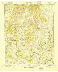
1936 Map of Primm
USGS Topo · Published 1936About this map
The Tennessee Valley Authority (TVA) transmission line cuts across this 1936 landscape, marking a period of modern infrastructure expansion into the rural borderlands of Hickman, Williamson, and Maury counties. This map captures a decentralized community network defined by local hubs like Primm, Kinderhook, and Whiteoak. The terrain is characterized by a dense system of creek valleys, including Lick Creek and Leipers Creek, where small settlements and rural institutions developed.
Find a feature on this map
57 named features on this map. Tap any name to fly to it.
Don’t see what you’re looking for? This feature index may not catch every label — zoom into the map to look around manually.
Map Details
Editions of this 1936 Primm Map
This is the sole edition of this map. No revisions or reprints were ever made.
Other maps of this area

1901 · Colombia
USGS Topo · 1:125,000

1936 · Godwin
USGS Topo · 1:24,000

1936 · Williamsport
USGS Topo · 1:24,000

1936 · Littlelot
USGS Topo · 1:24,000

1936 · Theta
USGS Topo · 1:24,000

1936 · Greenfield Bend
USGS Topo · 1:24,000

1936 · Craigfield
USGS Topo · 1:24,000

1936 · Lyles
USGS Topo · 1:24,000

1940 · Godwin
USGS Topo · 1:24,000
1941 · Godwin
USGS Topo · 1:24,000