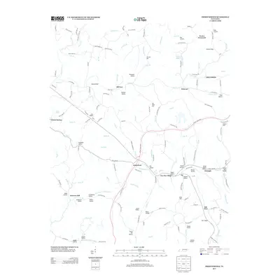
2013 Map of Primm Springs
USGS Topo · Published 2013About this map
Primm Springs and the surrounding Tennessee hill country are defined by a complex network of hollows and ridges that have shaped local settlement for generations. The landscape is crisscrossed by historic pathways, including the Old Natchez Trce and the modern Natchez Trace Pkwy, which traverse a terrain marked by family-named landmarks and old mill sites. Settled pockets like Kinderhook, New Flys Village, and Hill Town are connected by winding roads that follow the contours of the land, such as Leipers Creek Rd.
Find a feature on this map
149 named features on this map. Tap any name to fly to it.
Don’t see what you’re looking for? This feature index may not catch every label — zoom into the map to look around manually.
Map Details
Editions of this 2013 Primm Springs Map
This is the sole edition of this map. No revisions or reprints were ever made.
Other maps of this area

1901 · Colombia
USGS Topo · 1:125,000

1936 · Godwin
USGS Topo · 1:24,000

1936 · Williamsport
USGS Topo · 1:24,000

1936 · Primm
USGS Topo · 1:24,000

1936 · Littlelot
USGS Topo · 1:24,000

1936 · Theta
USGS Topo · 1:24,000

1936 · Greenfield Bend
USGS Topo · 1:24,000

1936 · Craigfield
USGS Topo · 1:24,000

1936 · Lyles
USGS Topo · 1:24,000

1940 · Godwin
USGS Topo · 1:24,000