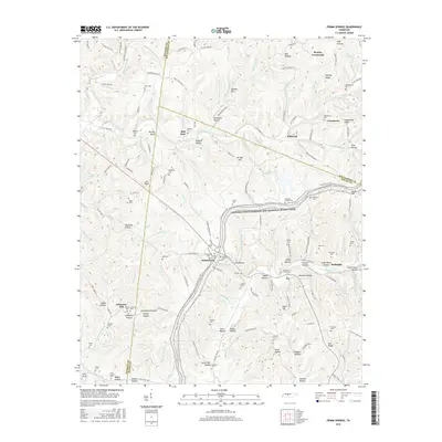
2016 Map of Primm Springs
USGS Topo · Published 2016About this map
Primm Springs and the surrounding borderlands of Hickman, Williamson, and Maury Counties are defined by a complex network of hollows and ridges that once supported a thriving agricultural and milling economy. This landscape is anchored by the historic path of the Natchez Trace National Scenic Trail, which bisects the region near Kinderhook. The reliance on local water power for early industry is evident at Johnsons Mill and the area near Mill Seat, where numerous tributaries like Leipers Cr and Lick Creek carve through the terrain. Genealogists will find a high density of family and community burial sites, including Johnsons Chapel Cem, Fly Cem, and Hilltown Cem. From the small settlements of Whiteoak and Beasley Crossroads to the named peaks of Hominy Ridge and Gordon Hill, the map documents a resilient rural character that has persisted for generations.
Find a feature on this map
201 named features on this map. Tap any name to fly to it.
Don’t see what you’re looking for? This feature index may not catch every label — zoom into the map to look around manually.
Map Details
Editions of this 2016 Primm Springs Map
This is the sole edition of this map. No revisions or reprints were ever made.
Other maps of this area

1901 · Colombia
USGS Topo · 1:125,000

1936 · Godwin
USGS Topo · 1:24,000

1936 · Williamsport
USGS Topo · 1:24,000

1936 · Primm
USGS Topo · 1:24,000

1936 · Littlelot
USGS Topo · 1:24,000

1936 · Theta
USGS Topo · 1:24,000

1936 · Greenfield Bend
USGS Topo · 1:24,000

1936 · Craigfield
USGS Topo · 1:24,000

1936 · Lyles
USGS Topo · 1:24,000

1940 · Godwin
USGS Topo · 1:24,000