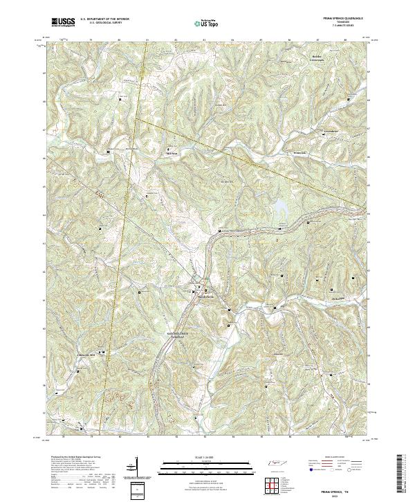
2022 Map of Primm Springs
USGS Topo · Published 2022About this map
Natchez Trace Parkway and the Old Natchez Trce slice diagonally through this Middle Tennessee landscape, following the high ground of Lick Ridge and Greenbrier Ridge. The terrain is deeply incised by a network of drainage basins, most notably Lick Creek and Leipers Cr, which have shaped the settlement patterns of small communities like Kinderhook, Fly, and Greenbrier. This survey captures the rural character of the borderlands between Hickman, Williamson, and Maury Counties, where family heritage is anchored in numerous upland burial grounds such as Oakley Cem, Slaughter Cem, and Byrd Cem.
Find a feature on this map
154 named features on this map. Tap any name to fly to it.
Don’t see what you’re looking for? This feature index may not catch every label — zoom into the map to look around manually.
Map Details
Editions of this 2022 Primm Springs Map
This is the sole edition of this map. No revisions or reprints were ever made.
Other maps of this area

1901 · Colombia
USGS Topo · 1:125,000

1936 · Godwin
USGS Topo · 1:24,000

1936 · Williamsport
USGS Topo · 1:24,000

1936 · Primm
USGS Topo · 1:24,000

1936 · Littlelot
USGS Topo · 1:24,000

1936 · Theta
USGS Topo · 1:24,000

1936 · Greenfield Bend
USGS Topo · 1:24,000

1936 · Craigfield
USGS Topo · 1:24,000

1936 · Lyles
USGS Topo · 1:24,000

1940 · Godwin
USGS Topo · 1:24,000