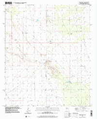
1996 Map of Prisor Hill
USGS Topo · Published 2002About this map
Aleman Ranch and the surrounding drainage basins define this arid landscape in Sierra County during the late twentieth century. The topography is dominated by the namesake Prisor Hill, which rises above a series of significant seasonal watercourses including Aleman Draw, Jornada Draw, and Lyons Draw. These natural corridors reflect the hydrological patterns of the Jornada del Muerto region, where water management is critical to ranching operations.
Find a feature on this map
18 named features on this map. Tap any name to fly to it.
Don’t see what you’re looking for? This feature index may not catch every label — zoom into the map to look around manually.
Map Details
Editions of this 1996 Prisor Hill Map
This is the sole edition of this map. No revisions or reprints were ever made.
Other maps of this area

1916 · Tonuco
USGS Topo · 1:125,000

1916 · Salinas Peak
USGS Topo · 1:125,000

1932 · Tonuco
USGS Topo · 1:125,000

1948 · Sowell
USGS Topo · 1:62,500

1948 · Chicken Well
USGS Topo · 1:62,500

1954 · Tularosa
USGS Topo · 1:250,000

1955 · Las Cruces
USGS Topo · 1:250,000

1958 · Las Cruces
USGS Topo · 1:250,000

1958 · Tularosa
USGS Topo · 1:250,000

1959 · Engle
USGS Topo · 1:62,500