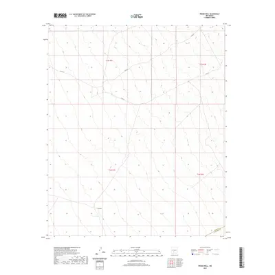
2020 Map of Prisor Well
USGS Topo · Published 2020About this map
Prisor Well serves as the central focal point for this landscape in Doña Ana County, situated in an area defined by its arid geography and essential water features. The map details the drainage of Lyons Draw, which cuts through the high desert terrain. This 2020 survey illustrates the remote road network utilized by ranchers and land managers, including Co Rd A021 and Co Rd 021, which traverse the township and range boundaries. The intersection of Sierra and Doña Ana counties is captured along the southern edge, highlighting the jurisdictional boundaries that define this portion of the New Mexico interior. For those researching land use or local geography, the map provides a precise look at how small-scale improvements like wells and county roads interface with the vast, open topography of the region.
Find a feature on this map
10 named features on this map. Tap any name to fly to it.
Don’t see what you’re looking for? This feature index may not catch every label — zoom into the map to look around manually.
Map Details
Editions of this 2020 Prisor Well Map
This is the sole edition of this map. No revisions or reprints were ever made.
Other maps of this area

1916 · Tonuco
USGS Topo · 1:125,000

1916 · Salinas Peak
USGS Topo · 1:125,000

1932 · Tonuco
USGS Topo · 1:125,000

1948 · Sowell
USGS Topo · 1:62,500

1948 · Chicken Well
USGS Topo · 1:62,500

1948 · Kaylor Mountain
USGS Topo · 1:62,500

1948 · Black Top Mountain
USGS Topo · 1:62,500

1954 · Tularosa
USGS Topo · 1:250,000

1955 · Las Cruces
USGS Topo · 1:250,000

1958 · Las Cruces
USGS Topo · 1:250,000