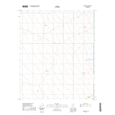
2023 Map of Prisor Well
USGS Topo · Published 2023About this map
White Sands Missile Range occupies the eastern portion of this high-desert landscape, where the land transitions from the jurisdiction of the Sierra and Doña Ana county line. The terrain is defined by the natural drainage of Lyons Draw, which cuts through the southwestern corner of the quadrangle. This 2023 survey by the U.S. Geological Survey details a sparse network of infrastructure in this arid region, primarily consisting of rugged local connectors such as Co Rd A021 and Co Rd 23. The map serves as a contemporary record of land use at the intersection of military restricted areas and public lands, illustrating the vast, unpopulated character of south-central New Mexico.
Find a feature on this map
9 named features on this map. Tap any name to fly to it.
Don’t see what you’re looking for? This feature index may not catch every label — zoom into the map to look around manually.
Map Details
Editions of this 2023 Prisor Well Map
This is the sole edition of this map. No revisions or reprints were ever made.
Other maps of this area

1916 · Tonuco
USGS Topo · 1:125,000

1916 · Salinas Peak
USGS Topo · 1:125,000

1932 · Tonuco
USGS Topo · 1:125,000

1948 · Sowell
USGS Topo · 1:62,500

1948 · Chicken Well
USGS Topo · 1:62,500

1948 · Kaylor Mountain
USGS Topo · 1:62,500

1948 · Black Top Mountain
USGS Topo · 1:62,500

1954 · Tularosa
USGS Topo · 1:250,000

1955 · Las Cruces
USGS Topo · 1:250,000

1958 · Las Cruces
USGS Topo · 1:250,000