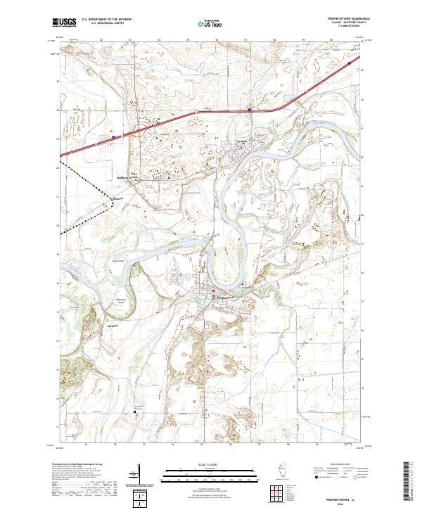
2024 Map of Prophetstown
USGS Topo · Published 2024About this map
Prophetstown and the wide bend of the Rock River define this Whiteside County landscape, where river islands and intricate waterways have shaped the development of local riverfront communities. The geography is characterized by several distinctive islands such as Indian Island and Millwoods Island, while the surrounding terrain is marked by local landmarks like Thunderbolt Hill. The settlement pattern follows both the riverbank and the established road network, connecting the larger center of Prophetstown to smaller locales like Portland, Lyndon, and Hamilton Corners.
Find a feature on this map
63 named features on this map. Tap any name to fly to it.
Don’t see what you’re looking for? This feature index may not catch every label — zoom into the map to look around manually.
Map Details
Editions of this 2024 Prophetstown Map
This is the sole edition of this map. No revisions or reprints were ever made.
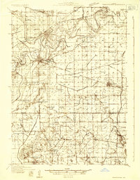
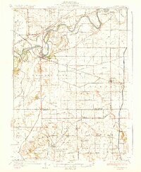
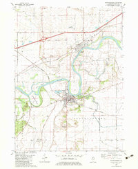
Historical Maps of Prophetstown Through Time
4 maps found