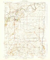
1936 Map of Prophetstown
USGS Topo · Published 1936About this map
The Rock River winds through the northern portion of this landscape, its banks defined by complex waterways like Hamilton Slough and Walker Slough. In the mid-1930s, this region of Whiteside County was a dense network of rural school districts and small rail-served hubs. The village of Prophetstown serves as a central anchor, where the Chicago Burlington and Quincy railroad crosses the river. Southward, the terrain transitions into a highly engineered drainage landscape, marked by County Ditch No 1 and County Ditch No 2, which reclaimed the lowlands for agriculture.
Find a feature on this map
86 named features on this map. Tap any name to fly to it.
Don’t see what you’re looking for? This feature index may not catch every label — zoom into the map to look around manually.
Map Details
Editions of this 1936 Prophetstown Map
3 editions found

Other maps of this area

1891 · Clinton
USGS Topo · 1:62,500

1894 · Clinton
USGS Topo · 1:62,500

1899 · Clinton
USGS Topo · 1:125,000

1921 · Buda
USGS Topo · 1:62,500

1923 · Buda
USGS Topo · 1:62,500

1929 · Annawan
USGS Topo · 1:62,500

1930 · Woodsung
USGS Topo · 1:48,000

1932 · Prophetstown
USGS Topo · 1:48,000

1932 · Annawan
USGS Topo · 1:62,500

1934 · Geneseo
USGS Topo · 1:62,500