
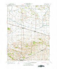
1929 Map of Annawan
USGS Topo · Published 1966About this map
The Illinois and Mississippi Canal cuts a striking horizontal line across this Henry and Bureau County landscape, accompanied by its distinctive Feeder Basin and a network of drainage channels like the Bureau County Ditch. This 1920s survey captures a rural Illinois economy defined by the intersection of water engineering and rail transport, with the Chicago Rock Island and Pacific and the Chicago Burlington and Quincy railroads serving the established towns of Annawan and Neponset.
Find a feature on this map
77 named features on this map. Tap any name to fly to it.
Don’t see what you’re looking for? This feature index may not catch every label — zoom into the map to look around manually.
Map Details
Editions of this 1929 Annawan Map
2 editions found
Other maps of this area

1899 · Clinton
USGS Topo · 1:125,000

1921 · Buda
USGS Topo · 1:62,500

1923 · Buda
USGS Topo · 1:62,500

1931 · Galva
USGS Topo · 1:48,000

1932 · Prophetstown
USGS Topo · 1:48,000

1932 · Annawan
USGS Topo · 1:62,500

1933 · Camp Grove
USGS Topo · 1:48,000

1934 · Geneseo
USGS Topo · 1:62,500

1936 · Prophetstown
USGS Topo · 1:62,500

1940 · Galva
USGS Topo · 1:62,500