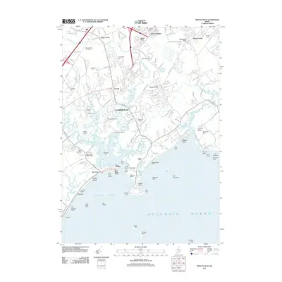
2011 Map of Prouts Neck
USGS Topo · Published 2011About this map
Scarborough occupies a complex coastal landscape where the Nonesuch River and Dunstan River converge to form a vast estuarine marshland protected by the barrier sands of Pine Point. This 2011 survey captures the intricate relationship between the region's suburban growth and its geological boundaries, featuring the prominent rocky headland of Prouts Neck and the long reaches of Grand Beach. Local history is anchored by sites like the Riverside Cemetery and Black Point Cemetery, while the area's recreational character is evident through the Scarborough Downs racing facility and several coastal resorts.
Find a feature on this map
150 named features on this map. Tap any name to fly to it.
Don’t see what you’re looking for? This feature index may not catch every label — zoom into the map to look around manually.
Map Details
Editions of this 2011 Prouts Neck Map
This is the sole edition of this map. No revisions or reprints were ever made.
Other maps of this area

1891 · Portland
USGS Topo · 1:62,500

1891 · Biddeford
USGS Topo · 1:62,500

1893 · Biddeford
USGS Topo · 1:62,500

1893 · Portland
USGS Topo · 1:62,500

1893 · Casco Bay
USGS Topo · 1:62,500

1914 · Portland
USGS Topo · 1:48,000

1914 · Casco Bay
USGS Topo · 1:48,000

1916 · Portland
USGS Topo · 1:62,500

1916 · Casco Bay
USGS Topo · 1:62,500

1916 · Portland And Vicinity
USGS Topo · 1:62,500