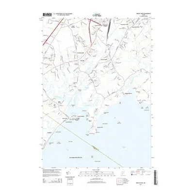
2014 Map of Prouts Neck
USGS Topo · Published 2014About this map
Prouts Neck and the surrounding coastline of Saco Bay define this 2014 survey, capturing a landscape where salt marshes meet residential growth. The geography is dictated by the intricate fingers of the Nonesuch River, Mill Brook, and the Dunstan River, which flow into the Atlantic near Pine Point. For genealogists, the map is remarkably dense with family-named burial sites, including the Eben Libby Farm Cem, Harty Cem, and Jordan Hanscom Cem. This record of Scarborough shows the modern footprint of settlements like Oak Hill and Eight Corners alongside older landmarks like The Great Grave near Massacre Pond. The corridor of the Maine Central railroad and the Maine Turnpike A A Rd illustrate the transit arteries that link these coastal villages to the broader region.
Find a feature on this map
200 named features on this map. Tap any name to fly to it.
Don’t see what you’re looking for? This feature index may not catch every label — zoom into the map to look around manually.
Map Details
Editions of this 2014 Prouts Neck Map
This is the sole edition of this map. No revisions or reprints were ever made.
Other maps of this area

1891 · Portland
USGS Topo · 1:62,500

1891 · Biddeford
USGS Topo · 1:62,500

1893 · Biddeford
USGS Topo · 1:62,500

1893 · Portland
USGS Topo · 1:62,500

1893 · Casco Bay
USGS Topo · 1:62,500

1914 · Portland
USGS Topo · 1:48,000

1914 · Casco Bay
USGS Topo · 1:48,000

1916 · Portland
USGS Topo · 1:62,500

1916 · Casco Bay
USGS Topo · 1:62,500

1916 · Portland And Vicinity
USGS Topo · 1:62,500