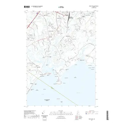
2021 Map of Prouts Neck
USGS Topo · Published 2021About this map
The coastal landscapes of South Portland and Scarborough meet along a jagged Atlantic shoreline defined by marshes and rocky points. This modern survey detail shows the complex hydrology of the Nonesuch River and Scarborough River, where the tidal waters of Nonesuch Cove and the Scarboro Marshes shape the local geography. Significant for local genealogists, the map identifies numerous small burial sites, including the Harmon Family Graves near Scottow Hill and the Olde Spurwink Plantation Cem. Prominent coastal features like Prouts Neck, Higgins Beach, and the historic Massacre Pond illustrate the transition from residential developments in Thornton Heights and Oak Hill to the preserved coastal marshes. The southern portion of the map covers the famous sands of Old Orchard Beach and Grand Beach, reaching out to landmarks like Bluff Island and Stratton Island in Saco Bay.
Find a feature on this map
190 named features on this map. Tap any name to fly to it.
Don’t see what you’re looking for? This feature index may not catch every label — zoom into the map to look around manually.
Map Details
Editions of this 2021 Prouts Neck Map
This is the sole edition of this map. No revisions or reprints were ever made.
Other maps of this area

1891 · Portland
USGS Topo · 1:62,500

1891 · Biddeford
USGS Topo · 1:62,500

1893 · Biddeford
USGS Topo · 1:62,500

1893 · Portland
USGS Topo · 1:62,500

1893 · Casco Bay
USGS Topo · 1:62,500

1914 · Portland
USGS Topo · 1:48,000

1914 · Casco Bay
USGS Topo · 1:48,000

1916 · Portland
USGS Topo · 1:62,500

1916 · Casco Bay
USGS Topo · 1:62,500

1916 · Portland And Vicinity
USGS Topo · 1:62,500