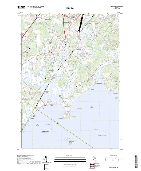
2024 Map of Prouts Neck
USGS Topo · Published 2024About this map
The Rachel Carson National Wildlife Refuge stretches across this coastal landscape, protecting the complex tidal estuaries formed by the Spurwink River, Nonesuch River, and Scarborough River. This environment is defined by the Scarboro Marshes and a series of rocky points and beaches, including Prouts Neck, Higgins Beach, and the northern edge of Old Orchard Beach. The inland geography is densely punctuated by small family burial grounds and historical markers, such as the Harmon Family Graves near Scottow Hill, the Indian Cem, and the Eben Libby Farm Cem, which offer significant value for genealogists tracing early settlement patterns in the Scarborough area.
Find a feature on this map
206 named features on this map. Tap any name to fly to it.
Don’t see what you’re looking for? This feature index may not catch every label — zoom into the map to look around manually.
Map Details
Editions of this 2024 Prouts Neck Map
This is the sole edition of this map. No revisions or reprints were ever made.
Other maps of this area

1891 · Portland
USGS Topo · 1:62,500

1891 · Biddeford
USGS Topo · 1:62,500

1893 · Biddeford
USGS Topo · 1:62,500

1893 · Portland
USGS Topo · 1:62,500

1893 · Casco Bay
USGS Topo · 1:62,500

1914 · Portland
USGS Topo · 1:48,000

1914 · Casco Bay
USGS Topo · 1:48,000

1916 · Portland
USGS Topo · 1:62,500

1916 · Casco Bay
USGS Topo · 1:62,500

1916 · Portland And Vicinity
USGS Topo · 1:62,500