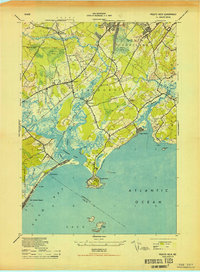
1944 Map of Prouts Neck
USGS Topo · Published 1944About this map
Prouts Neck anchors this coastal landscape where the Nonesuch River and Libby River converge into a complex network of salt marshes and tidal estuaries. During the mid-1940s, this area of Cumberland County balanced its established maritime identity with modern technological and military shifts. The presence of an Observation Post on the rocky peninsula and an Abandoned Airport near Scarboro suggests the wartime focus of the era, while the WCSH NE Radio Tower on Hunwall Hill marks early telecommunications infrastructure.
Find a feature on this map
54 named features on this map. Tap any name to fly to it.
Don’t see what you’re looking for? This feature index may not catch every label — zoom into the map to look around manually.
Map Details
Editions of this 1944 Prouts Neck Map
This is the sole edition of this map. No revisions or reprints were ever made.
Other maps of this area

1891 · Portland
USGS Topo · 1:62,500

1891 · Biddeford
USGS Topo · 1:62,500

1893 · Biddeford
USGS Topo · 1:62,500

1893 · Portland
USGS Topo · 1:62,500

1893 · Casco Bay
USGS Topo · 1:62,500

1914 · Portland
USGS Topo · 1:48,000

1914 · Casco Bay
USGS Topo · 1:48,000

1916 · Portland
USGS Topo · 1:62,500

1916 · Casco Bay
USGS Topo · 1:62,500

1916 · Portland And Vicinity
USGS Topo · 1:62,500